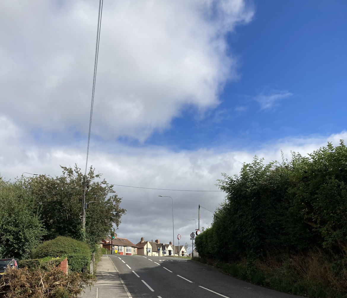
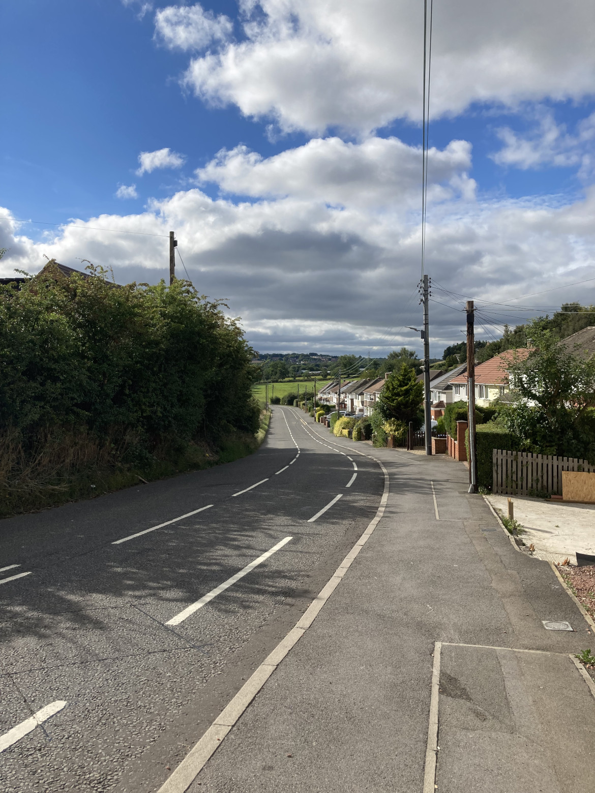
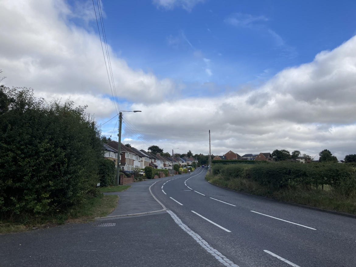
Toll House Road is the asset of the month for August. (See List of Assets of the month.) Toll House Road nowadays joins the A167 in Crossgate Moor at a three-way traffic light junction and provides access to the village and parish of Bearpark to the West of Durham City. It is a road with significant historical and landscape significance.
In the 1980s a site alongside Toll House Road was proposed for housing development. A Crossgate Moor Action Group was formed to oppose this, and the City of Durham Trust was also in opposition. The campaign opposing the development was eventually successful. If anyone has any information about this campaign please let us know.
Junction with A167Looking down roadLooking up road
Toll House Road is named from an old tollgate that was situated in the area (possibly the Redhills Tollgate near the later ‘Pot and Glass’ pub on the A167), and is part of the remaining historical route to Beaurepaire and the surrounding moor, farm and park land. The ‘Prior’s Path ran from near Redhills Lane, close to Toll House Road, then past Arbour House and Stotgate Farm. Beaurepaire, a Grade II listed building, was a medieval manor house built as country retreat for the Priors of Durham. The ruins of Beaurepaire have been recently renovated by local volunteers supported by DREAM a not-for-profit, community interest company
Toll House Road lies within the site of the Battle of Neville’s Cross, a listed battlefield (see listing and battle information). As you pass along Toll House Road you would be between the lines of the two armies; the English to the south and the Scots to the north. There is current academic work reviewing the exact location of this battle.
In the late 18th century mills were established along the River Browney, one – Moorsley Banks, a paper mill – was situated off Toll House Road, near Crossgate Moor, and lasted till the end of the 19th century. A small copse just east of the mill site alongside Toll House Road marks the site of the original ‘Pot and Glass Inn’, probably in existence from the late 18th to early 19th centuries. It closed about 1938 and its licence transferred to ‘The Neville Dene’ along the Great North Road (Newcastle Road, A167). This became called the ‘Pot and Glass’ (later ‘The Lodge’) and remained a pub till it became a Sainsbury’s supermarket in 2013/14.
Toll House Road lies within an Area of Higher Landscape Value (designated within the County Durham Local Plan) and abuts the Green Belt.
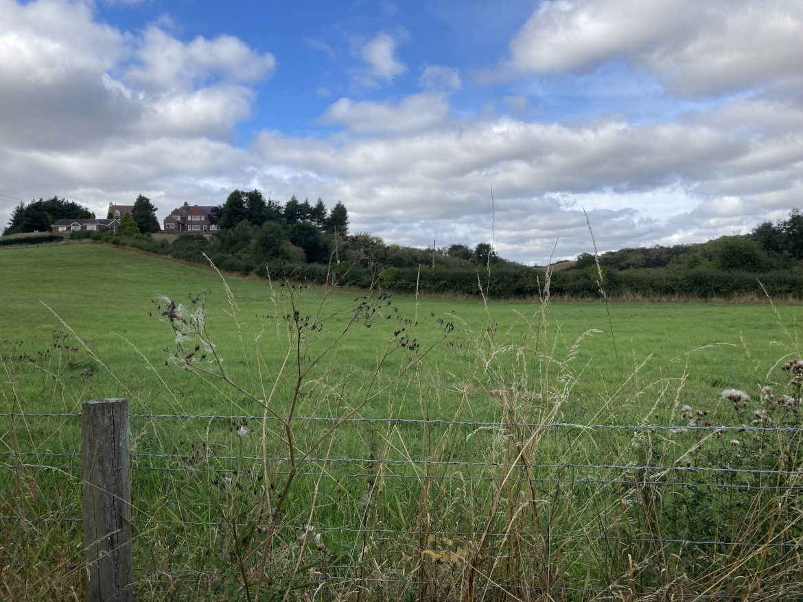
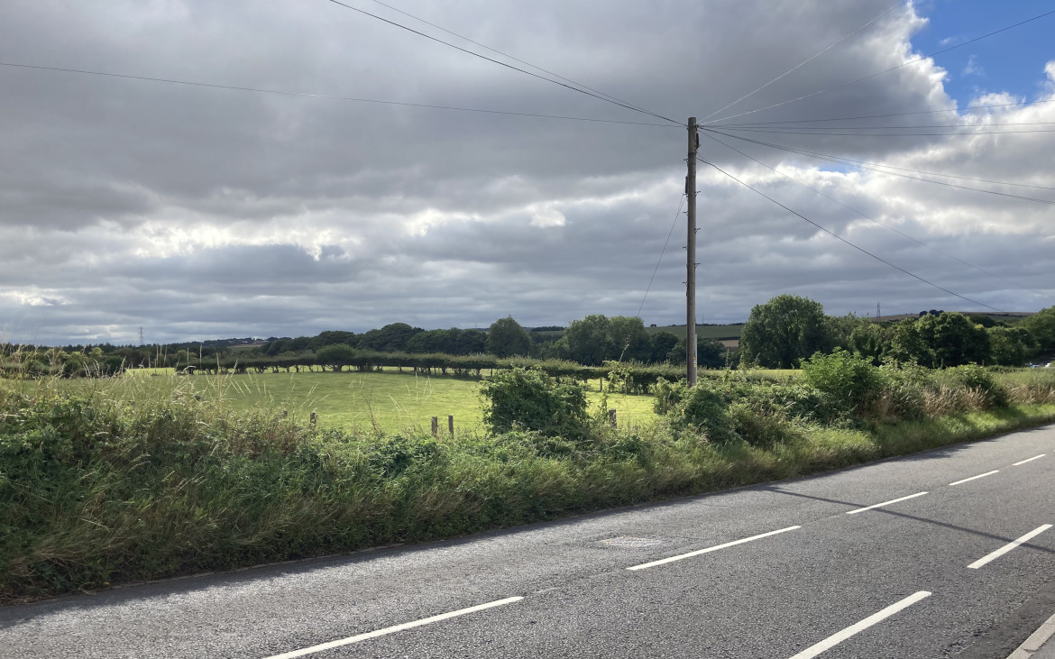
Fields to North, showing Arbour HouseFields to South
The Trust’s Annual Report for 1984 recorded that the Trust lodged an objection to a proposal for housing in Toll House Road as this was in breach of the principles of the then County Structure Plan (1981), e.g. it lay within the Green Belt and an Area of Great Landscape Value. The Trust’s 1985 Annual Report stated: “The Green Belt between Langley Moor and Neville’s Cross could hardly be narrower; what there is has been designated an Area of Great Landscape Value. Both the Structure Plan and [the emerging] District Plan scheduled its preservation, but, then, we live in a democracy which can cock a snook at planning if it so decides. A not too dissimilar process could be taking place at Tollhouse Lane where an on-off, on-off situation has prevailed over the proposal for housing.”
Quote from the Annual Report, 1986
The most important Inquiry was held in October. Ostensibly it was to hear the appeal by Leech Homes against refusal of planning permission for 50 houses on 91/2 acres at Tollhouse Rd. In effect, this second battle of Neville’s Cross – the anniversary of the 1346 event occurred during the Inquiry – was about what sort of Durham there would be in the future. The District and County Authorities were fighting the battle of the Structure Plan all over again. At that earlier time (1981) the Secretary of State recommended very restricted growth for the central City, supporting the report of his Examination in Public panel, which reflected the views of the county Authority and City Trust. The District had argued for a bigger central area, and were now ‘mindful to approve’ the Leech application.
The Trust’s evidence, apart from mentioning the contravention of four Structure Plan policies, concern at vehicular access problems and the neglect of opinion after a public opinion exercise, attempted to expose the real threat behind the appeal. The simplest measure of the latter was to compare the maximum population increase, 1981-1991, of 100 per year set by the Secretary of State when authorising the Structure Plan, with the alleged gross need for the annual housing of 168! (Replacement because of demolition is virtually nil). The Trust did not object on grounds of a possible Western By-pass, since it did not wish to put forward one possible development in order to trump another. (The County did just this, and having shot themselves through the foot, had to argue for the cleanliness of the wound. Three additional alternative routes were presented in detail but admitted to be even more costly and environmentally damaging, which exercise only compounded the mystery of having apparently pointed the gun at more vital parts of the anatomy). A decision is still awaited from the Secretary of State.
Quote from Bulletin No: 25, November 1986
This autumn has seen the decision on the Tollhouse Road public inquiry, where the Secretary of State agreed with the view taken by the Trust, that housing be not allowed. The District planning authority had supported the applicant’s case in favour of housing; the Council has since voted to retain the site for housing in its Local Plan, and thus the arguments and counter-arguments will have to be aired again before another inspector at the Plan inquiry.
Quote from the Annual Report 1988
This last year has seen the [City of Durham] Local Plan complete its final stages – a public inquiry, publication of the inspector’s report, the Council response and proposed modifications and, finally, the public’s opportunity to make representation on such modifications. The Trust argued successfully against housing at Tollhouse Rd and against the removal of landscape value status … Following the Council’s response to the crucial housing and population strategy, Trustees still consider that the authority has not fully grasped the nettle as advised by the inspector. (The inspector recommended an urgency in discovering whether sufficient housing sites were available in the district to resolve the question of the relative contributions of central urban area and rest of district and, thus, to resolve whether in fact its achievement of an overall total of 87,000 is feasible. If not, than what the District has called a ‘target’ but what the County has deemed a ‘ceiling’ would have to be abandoned.)
This episode demonstrates the then District Council’s unwillingness to accept the results of the democratic and legal processes resulting in the Structure Plan and emerging associated District Plan and to then uphold these policies when assessing development proposals. Also to continue putting forward sites for development that had previously been ruled out in a public inquiry. It is interesting (and frustrating) to see the same pattern recurring with current developments, where the County Council is unwilling to uphold the policies in its own Local Plan; the Bent House site is a case in point. However, it should be noted that there are some improvements in this respect, e.g. the production of a Masterplan by the Council for the Sniperley site, though the Trust has noted some weaknesses in this.
Sources of information
David Simpson (2006) Durham City. The Northern Echo. Business Education Publishers Ltd, p.88-93
David Simpson (2006) The Durham Villages. The Northern Echo. Business Education Publishers Ltd, p.93-95