The National Planning Policy Framework (NPPF) as published on 20th July 2021 states this about protecting Green Belt land:
137. The government attaches great importance to Green Belts. The fundamental aim of Green Belt policy is to prevent urban sprawl by keeping land permanently open; the essential characteristics of Green Belts are their openness and their permanence.
138. Green Belt serves 5 purposes:
(a) to check the unrestricted sprawl of large built-up areas;
(b) to prevent neighbouring towns merging into one another;
(c) to assist in safeguarding the countryside from encroachment;
(d) to preserve the setting and special character of historic towns; and
(e) to assist in urban regeneration, by encouraging the recycling of derelict and other urban land.
Below is a history of the development of the Green Belt for Durham City and details of how the Trust and individual Trust members were involved in this process.
Background to the Green Belt
The first “Green Belt” appeared as the Metropolitan Green Belt around London in 1935. The Government’s Town & Country Planning Act 1947 allowed planning authorities to include green belt proposals in their development plans. In 1955 the Government published its Green Belt Circular 42/55 inviting planning authorities to submit proposals for Green Belts giving statutory and permanent protect to areas of primarily open land around cities and between towns. Currently, the Government sets out its policies and principles towards the green belts in the National Planning Policy Framework (as above).
The County Development Plan 1954
Durham County Council prepared the first County Durham Development Plan, under the Labour Government’s Town & Country Planning Act 1947. The Draft Written Statement, Written Analysis and County Map were submitted in 1951 and approved with amendments by the Minister of Housing & Local Government on 19th February 1954. It is essential to refer to the 1954 Approved Plan documents despite the fact that in public libraries and general availability the 1951 documents are most prominent. Only the 1954 Approved documents have statutory force. The Plan designates Areas of Great Landscape Value such as West Durham but nothing around Durham City. A Town Map for Durham City area is promised but never happens.
Draft Green Belt Map under Circular 42/55
Immediately this Circular appeared, the County Council prepared a draft Green Belt Map which it submitted to the Minister at the end of 1955, including a Green Belt around Durham City. In his response in March 1957 the (Conservative) Minister agreed that a partial Green Belt for Durham City should be incorporated in the County Development Plan “to maintain its unique character”. Agreement was reached with the Minister that a partial Green Belt for Durham City to the east, south and west sides of the City could be adopted for the control of development pending the statutory vehicle of an Amendment by way of a County Development Plan Review. Thus since 1957 the partial Green Belt was applied by the County Council to all development proposals within the defined area, and its decisions were upheld by Government Inspectors on appeals against refusals of permission.
The County Development Plan Amendment No 39 1969
Ten years after the 1954 Approved Plan, the County Council submitted a review, update and revision in the form of County Development Plan Amendment No 39. This was approved with amendments by the Minister of Housing & Local Government in 1969. Again, it is essential to refer to the 1969 Approved documents despite the fact that in public libraries and general availability the 1964 documents are most prominent and indeed are often the only version available. Only the 1969 Approved documents have statutory force.
The 1964 Submitted Review proposed the designation of several Areas of Great Landscape Value, and for Durham City it proposed a Green Belt around the west, south and east sides of the city, arguing that there was plenty of room for housing and other development to be accommodated northwards. This proposal accorded with the agreement with the then Minister in 1957. However, the 1964 Minister in approving the Plan with amendments declined to approve a partial Green Belt for Durham City but after negotiations did agree instead to approve the same proposed area as an Area of Great Landscape Value but with the exact wording of the national green belt policy. This device proved successful, again with consistent support by Inspectors on appeals.
The boundary of the Durham ‘Green Belt’ that acquired statutory force with the approval of the County Development Plan Amendment No 39 in 1969 is defined precisely in Diagram 15 of the Written Analysis. It does not include the north side of the city, nor does it include Aykley Heads.
The first Durham County Structure Plan
Structure Plans consisted of a broad framework of policies looking forward up to 20 years ahead, supported by a “key diagram” showing land use, transport and environmental proposals diagrammatically (that is, not on a locationally-specific map base). Local Plans, usually prepared by district rather than county councils, were required to accord with the overall strategy set out in the structure plan. It is in local plans that precise boundaries are defined.
The Durham County Structure Plan approved in January 1981 had two strategic policies for protecting the unique setting of Durham City. Policy 98 declared an Area of Great Landscape Value around the west, south and east sides of the City; and Policy 126 required protection of the traditional setting by conserving the wooded slopes and horizons and views to and from the Cathedral and Castle.
The City of Durham Local Plan 1988
Detailed application of the 1981 County Structure Plan strategic policies were set out in the City of Durham Local Plan started in 1978 and adopted in June 1988. Applying County Structure Plan Policy 98, the draft Local Plan proposed a detailed boundary for the Area of Great Landscape Value (AGLV) but the Public Inquiry Inspector modified it by following the County Council’s Interim Boundary adopted in 1980. This brought the inner AGLV boundary tight up against the existing ribbon of housing development west of the A167 and covered the area of the proposed housing site H1.23 at Tollhouse Road which he deleted.
County Structure Plan Review 1999
After a series of annual reports and formal Alterations to update certain policies and to extend the Plan period to 1996, a full review resulted in a new County Structure Plan approved in March 1999. Policy 5 of the 1999 County Durham Structure Plan made provision for a Green Belt in North Durham which extended from Tyne and Wear and encompassed Durham City. The general extent to the Green Belt around Durham was to reach south westwards from Chester-le-Street, east of Kimblesworth, south of Witton Gilbert, east of Bearpark, and southwards to Croxdale and then north-eastwards to Sherburn and West Rainton, to encircle Durham City.
The County Structure Plan 1999 made clear that an all-encompassing Green Belt around Durham City was necessary to preserve its special character and setting which encompasses the high quality landscape and undulating topography of open land around the City along with strategic gaps between settlements. It highlighted the importance of maintaining the strategic gap between Chester-le-Street and Durham City to prevent the linking up of these urban areas.
The City of Durham Local Plan 2004
Work on updating and rolling forward the City of Durham Local Plan started in 1996 and was approved in 2004. Applying the 1999 County Structure Plan Policy 5, the detailed boundaries of the Green Belt surrounding Durham City included land which is vital to the character and setting of Durham City and is likely to be subject to development pressures which cannot be controlled by normal development control policies. It included green fingers of land that penetrate the City at Aykley Heads and Flass Vale; substantial areas of high landscape value around the City, including parts of the Browney Valley and the Wear Valley; and the strategic gap to the north of the City, adjacent to the proposed Chester-le-Street Green Belt.
Saved Polices
The Planning and Compulsory Purchase Act 2004 abolished structure and local plans (just as Durham City’s Local Plan managed to get approved). Instead, Local Development Frameworks had to be produced. In the interim, the Act allowed some local plan policies to be ‘saved’ until they are replaced by new policies in the County Durham Local Development Documents. For Durham City, the Secretary of State agreed to a set of saved policies in 2007. The Saved Policies 2007 continued to be in force until they were superseded by the County Durham Plan in October 2020.
County Durham Plan 2020
Policy 20 Green Belt states “Development proposals within the Green Belt will be determined in accordance with national planning policy.” County Durham Plan p.122 to 126
Role of the Trust
The methods the Trust uses to comment on development within the City are many. We respond to national and local planning initiatives by engaging with consultations, lobbying the council and the national Department for Levelling Up, Housing & Communities, and making our views and objections known at public inquiries. We also respond to individual development proposals with objections and constructive comments, or support where appropriate.
With respect to the various stages of the production of a Green Belt for Durham City, the Trust was active in responding to all the development plans from the 1950s up to the current County Durham Plan, and appearing at all the associated public inquiries. With respect to current development proposals, the Trust upholds the Green Belt and associated national and local policies for its protection in our objections and comments. It is unfortunate that parts of the Green Belt have been withdrawn despite strong objections from the Trust and other organisations and individuals. The largest of these is the release of Sniperley Park for a sustainable urban extension. But there have also been successes e.g. the defeat of plans for the Western Relief Road. On a smaller scale there have also been failures and successes affecting building on the Green Belt, e.g. the shipping containers at Shincliffe garden centre for holiday accommodation were approved; redevelopment of the stables into a residential dwelling at Fernhill on the Newcastle Road was refused.
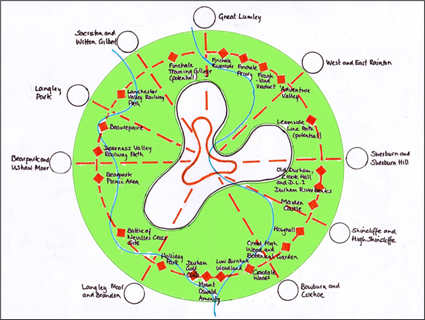
The Trust works with other organisations and individuals in the City. One example is the Durham Green Belt Group who have been very active in protecting the Green Belt and promoting the beneficial use of it as proposed in its Local Plan submissions. Here, the case was made for the provision of better footpaths and cycleways to link villages and the City to visitor attractions and amenities and would be developed for walking and cycling to school and work, while being enjoyed for leisure, education, conservation, sports and amenity use. In essence, it was not only a recreation and leisure initiative, but also one with economic benefits from investments in visitor and tourism infrastructure and social well- being benefits from all that use it (see the schematic diagram below).
A positive example of how the Green Belt can be enhanced is offered by a member of the Trust, David Miller, who is working on Initiative 7 in the Neighbourhood Plan’s ‘Looking Forward’ document. This initiative addresses ‘Identifying, Conserving and Improving Footpaths In and Around Durham City’. David has proposed three trails which are concentric and have the World Heritage Site as the heart of all three.
The three trails are:
The City Centre Heritage Trail (currently under consideration by the Trust and the Parish Council)
The Durham Seven Hills Trail (published by the Parish Council in November 2021)
The Durham Green Belt Trail
David is currently looking for support for a full feasibility study for a Green Belt Trail having scoped a route with a number of alternative sections of route. He is hoping that the National Trust will become a supporter in that the Trust is giving consideration to a green corridor linking Crook Hall Gardens with the wider Green Belt.
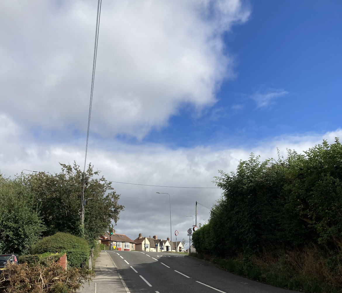
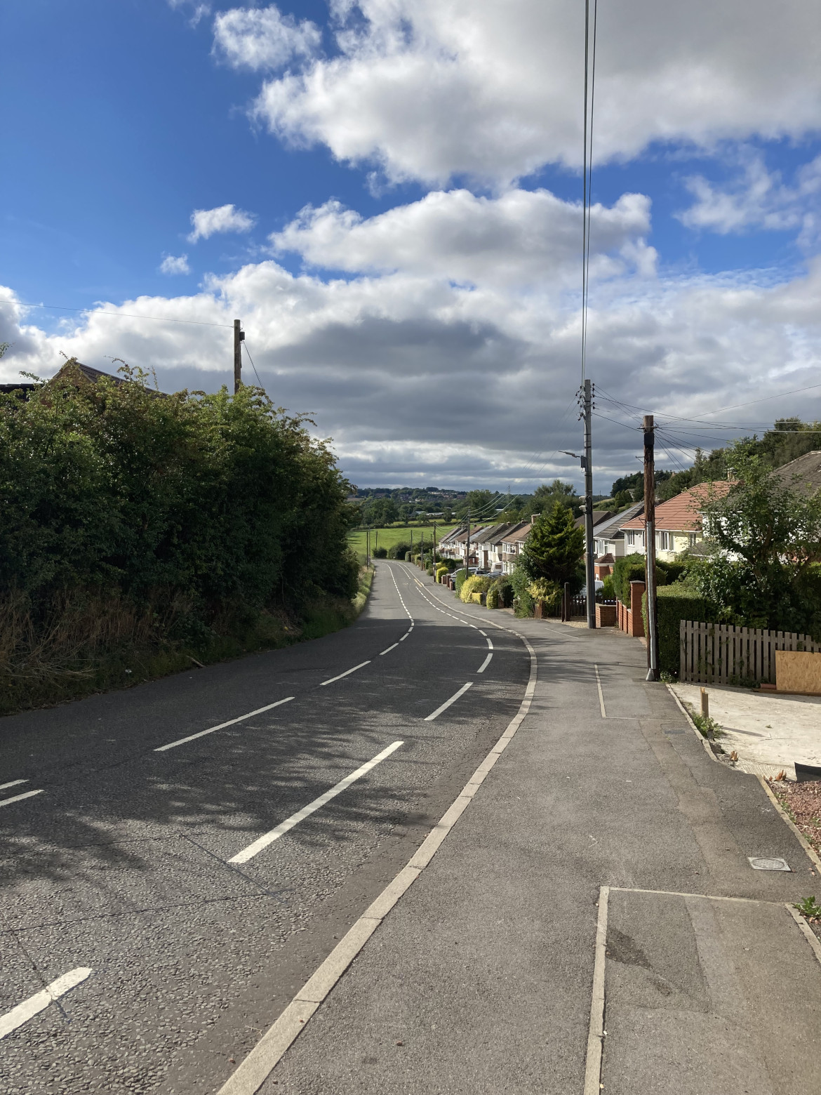
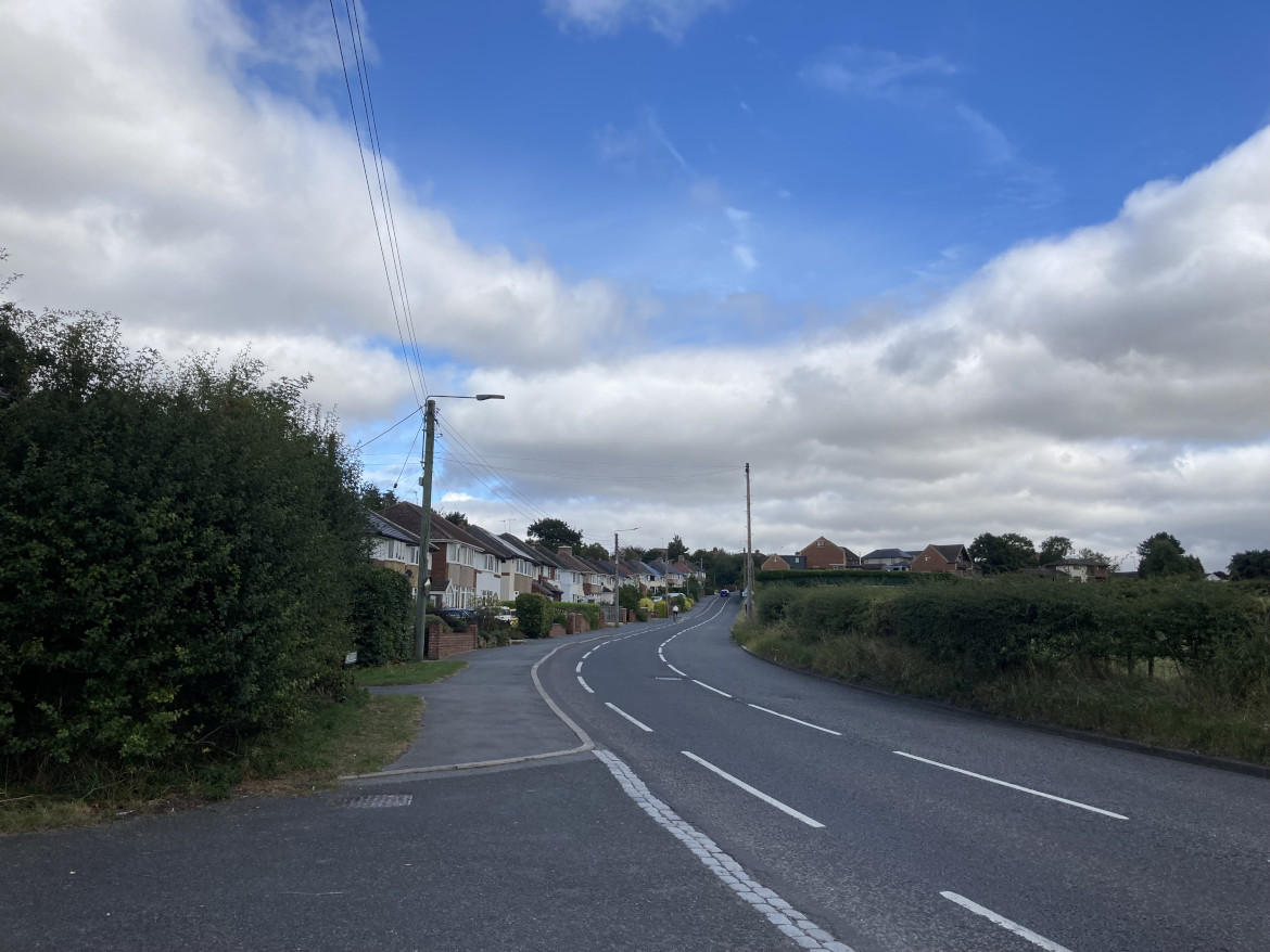
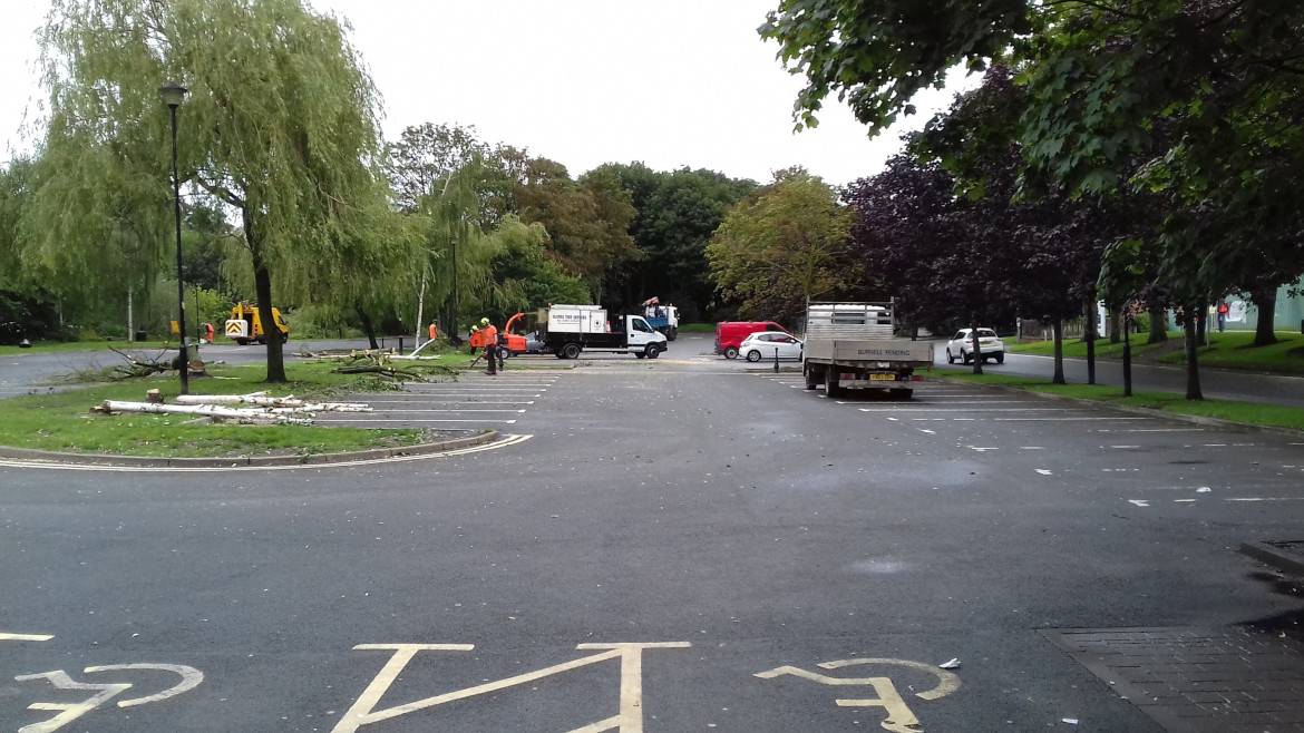
Toll House Road is the asset of the month for August. (See List of Assets of the month.) Toll House Road nowadays joins the A167 in Crossgate Moor at a three-way traffic light junction and provides access to the village and parish of Bearpark to the West of Durham City. It is a road with significant historical and landscape significance.
In the 1980s a site alongside Toll House Road was proposed for housing development. A Crossgate Moor Action Group was formed to oppose this, and the City of Durham Trust was also in opposition. The campaign opposing the development was eventually successful. If anyone has any information about this campaign please let us know.
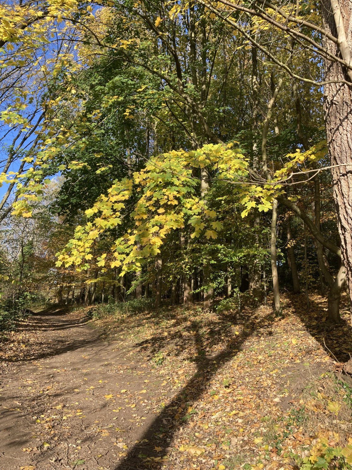
Junction with A167Looking down roadLooking up road
Toll House Road is named from an old tollgate that was situated in the area (possibly the Redhills Tollgate near the later ‘Pot and Glass’ pub on the A167), and is part of the remaining historical route to Beaurepaire and the surrounding moor, farm and park land. The ‘Prior’s Path ran from near Redhills Lane, close to Toll House Road, then past Arbour House and Stotgate Farm. Beaurepaire, a Grade II listed building, was a medieval manor house built as country retreat for the Priors of Durham. The ruins of Beaurepaire have been recently renovated by local volunteers supported by DREAM a not-for-profit, community interest company
Toll House Road lies within the site of the Battle of Neville’s Cross, a listed battlefield (see listing and battle information). As you pass along Toll House Road you would be between the lines of the two armies; the English to the south and the Scots to the north. There is current academic work reviewing the exact location of this battle.
In the late 18th century mills were established along the River Browney, one – Moorsley Banks, a paper mill – was situated off Toll House Road, near Crossgate Moor, and lasted till the end of the 19th century. A small copse just east of the mill site alongside Toll House Road marks the site of the original ‘Pot and Glass Inn’, probably in existence from the late 18th to early 19th centuries. It closed about 1938 and its licence transferred to ‘The Neville Dene’ along the Great North Road (Newcastle Road, A167). This became called the ‘Pot and Glass’ (later ‘The Lodge’) and remained a pub till it became a Sainsbury’s supermarket in 2013/14.
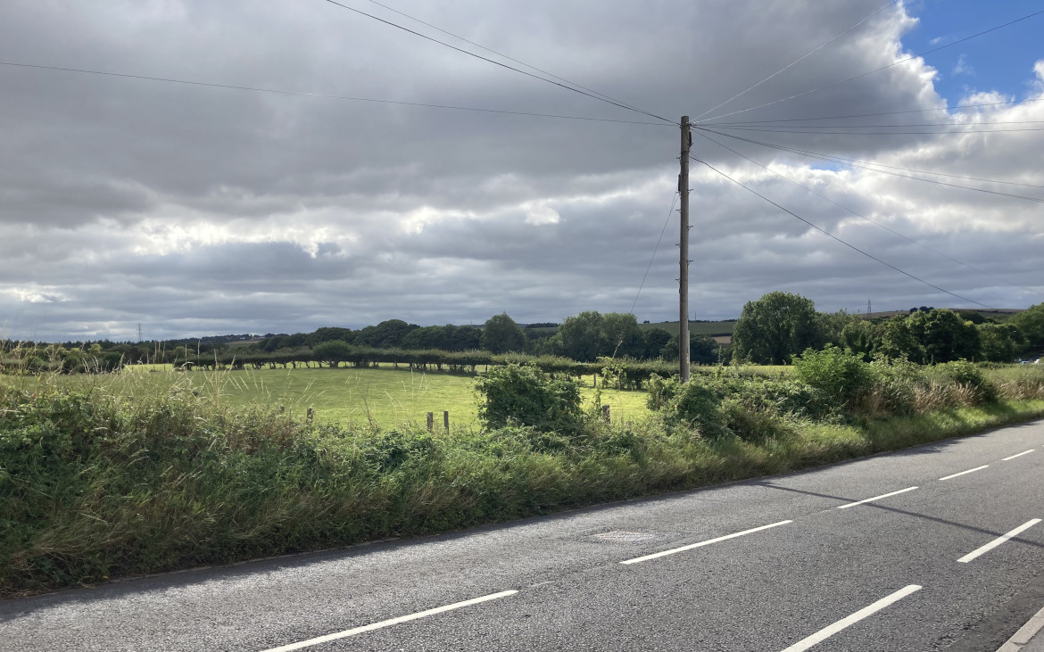
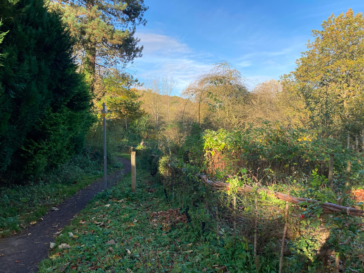
Toll House Road lies within an Area of Higher Landscape Value (designated within the County Durham Local Plan) and abuts the Green Belt.
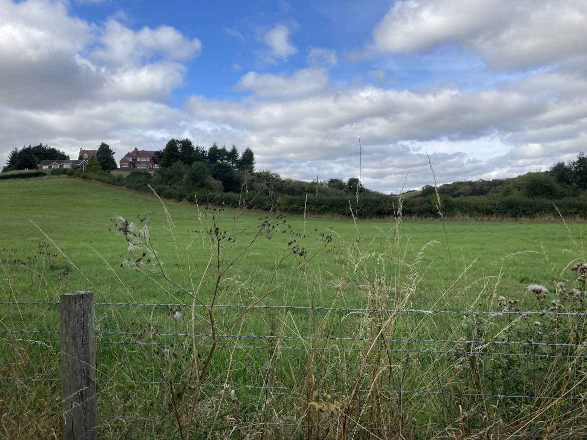
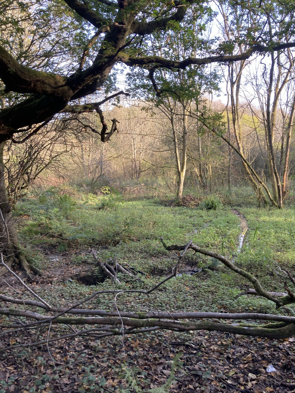
Fields to North, showing Arbour HouseFields to South
The Trust’s Annual Report for 1984 recorded that the Trust lodged an objection to a proposal for housing in Toll House Road as this was in breach of the principles of the then County Structure Plan (1981), e.g. it lay within the Green Belt and an Area of Great Landscape Value. The Trust’s 1985 Annual Report stated: “The Green Belt between Langley Moor and Neville’s Cross could hardly be narrower; what there is has been designated an Area of Great Landscape Value. Both the Structure Plan and [the emerging] District Plan scheduled its preservation, but, then, we live in a democracy which can cock a snook at planning if it so decides. A not too dissimilar process could be taking place at Tollhouse Lane where an on-off, on-off situation has prevailed over the proposal for housing.”
Quote from the Annual Report, 1986
The most important Inquiry was held in October. Ostensibly it was to hear the appeal by Leech Homes against refusal of planning permission for 50 houses on 91/2 acres at Tollhouse Rd. In effect, this second battle of Neville’s Cross – the anniversary of the 1346 event occurred during the Inquiry – was about what sort of Durham there would be in the future. The District and County Authorities were fighting the battle of the Structure Plan all over again. At that earlier time (1981) the Secretary of State recommended very restricted growth for the central City, supporting the report of his Examination in Public panel, which reflected the views of the county Authority and City Trust. The District had argued for a bigger central area, and were now ‘mindful to approve’ the Leech application.
The Trust’s evidence, apart from mentioning the contravention of four Structure Plan policies, concern at vehicular access problems and the neglect of opinion after a public opinion exercise, attempted to expose the real threat behind the appeal. The simplest measure of the latter was to compare the maximum population increase, 1981-1991, of 100 per year set by the Secretary of State when authorising the Structure Plan, with the alleged gross need for the annual housing of 168! (Replacement because of demolition is virtually nil). The Trust did not object on grounds of a possible Western By-pass, since it did not wish to put forward one possible development in order to trump another. (The County did just this, and having shot themselves through the foot, had to argue for the cleanliness of the wound. Three additional alternative routes were presented in detail but admitted to be even more costly and environmentally damaging, which exercise only compounded the mystery of having apparently pointed the gun at more vital parts of the anatomy). A decision is still awaited from the Secretary of State.
Quote from Bulletin No: 25, November 1986
This autumn has seen the decision on the Tollhouse Road public inquiry, where the Secretary of State agreed with the view taken by the Trust, that housing be not allowed. The District planning authority had supported the applicant’s case in favour of housing; the Council has since voted to retain the site for housing in its Local Plan, and thus the arguments and counter-arguments will have to be aired again before another inspector at the Plan inquiry.
Quote from the Annual Report 1988
This last year has seen the [City of Durham] Local Plan complete its final stages – a public inquiry, publication of the inspector’s report, the Council response and proposed modifications and, finally, the public’s opportunity to make representation on such modifications. The Trust argued successfully against housing at Tollhouse Rd and against the removal of landscape value status … Following the Council’s response to the crucial housing and population strategy, Trustees still consider that the authority has not fully grasped the nettle as advised by the inspector. (The inspector recommended an urgency in discovering whether sufficient housing sites were available in the district to resolve the question of the relative contributions of central urban area and rest of district and, thus, to resolve whether in fact its achievement of an overall total of 87,000 is feasible. If not, than what the District has called a ‘target’ but what the County has deemed a ‘ceiling’ would have to be abandoned.)
This episode demonstrates the then District Council’s unwillingness to accept the results of the democratic and legal processes resulting in the Structure Plan and emerging associated District Plan and to then uphold these policies when assessing development proposals. Also to continue putting forward sites for development that had previously been ruled out in a public inquiry. It is interesting (and frustrating) to see the same pattern recurring with current developments, where the County Council is unwilling to uphold the policies in its own Local Plan; the Bent House site is a case in point. However, it should be noted that there are some improvements in this respect, e.g. the production of a Masterplan by the Council for the Sniperley site, though the Trust has noted some weaknesses in this.
Sources of information
David Simpson (2006) Durham City. The Northern Echo. Business Education Publishers Ltd, p.88-93
David Simpson (2006) The Durham Villages. The Northern Echo. Business Education Publishers Ltd, p.93-95
The City of Durham Trust reacts to opportunities and threats at both national and local levels. Such activity can result in the Trust arguing its case at public inquiries etc. Common Land within the City gives an example of this, and is the asset of the month for July. (See List of assets of the month.)
The Commons Registration Act 1965 required the registration of rights to common land, town greens, and village greens in England and Wales. If land was not so registered within the timescale set then people’s right to this land use was lost. The Durham City Trust, in collaboration with other organisations, responded to this opportunity offered by national legislation and sought to register land within the City as common land.
The Trust called for people in the City to bring forth evidence that they had used land for passtime or pasture for over 20 years.
Quote from Bulletin No: 3, Winter 1967/68
Within the next few months all common lands must be registered, subject to subsequent objections, if they are to be preserved for posterity. There are many unoccupied (and perhaps wrongly occupied) pieces of ground which will only be saved if someone with knowledge of their history will come forward now and tell us; or if those who can try to find out will do so. Some of Gilesgate Green, for instance, belongs to the house-holders individually, but does it all? One of our great blessings is the amount of open grass and woodland in and around the city, but how much of it is really ours, and can it be made so securely?
The Durham and Northumberland Naturalists’ Trust is equally concerned about the much wider county areas, and the Secretary, Mr. Barry Woodward (University Science Site, South Road, Durham), would welcome evidence, as would our own Secretary for the city. Customary use by the inhabitants of a locality, for pastime or pasture over not less than twenty years, is the requisite fact.
Quote from Bulletin No: 9, November 1973
Under the terms of the Commons Registration Act 1965, the Trust in 1969 registered as Common five parcels of land in Durham City. The registration of these five parcels has undergone varying fates.
(i) Observatory Field. A majority of the Trustees came to feel in 1971 that the case for registration could not be substantiated. The registration was therefore withdrawn but, since the original application had been made on the petition of a number of members whose interests, it was felt, should be safeguarded, an attempt was made to transfer the registration from official Trust sponsorship to sponsorship by individual members. This attempt was however, unsuccessful.
(ii) Open land at the east end of Old Elvet. No objections were received within the specified period. It is therefore assumed that the registration stands.
(iii) Flass Vale. Three objections were received within the specified period. They were lodged by the Executors of Holliday, Decd., by N. Williamson Esq., and by Durham Corporation in relation to areas of the Vale which each owns, or owned, at the time of the objection.
(iv) Little High Wood. One objection was received within the permitted period. It was lodged by Durham University.
(v) Maiden castle. As (iv).
In the cases of (iii)> (iv) and (v), therefore, the question of registration as Common will now have to be argued pefore the Commons Commissioners who have already begun hearings. The Trust will have to show that the land is either subject to rights of common as defined in the Act or waste of a manor Three small sub-committees have begun to examine what arguments, if any, can be put before the Commissioners and whether the registrations should in any case stand within the boundaries originally specified by the Trust. These committees would warmly welcome the assistance of any member of the Trust (or indeed of anybody else!) in bringing to light any relevant evidence.
The Trust was successful in registering part of Flass Vale as Common Land. See post on Flass Vale for further details. The work of others resulted in the registration of The Sands and land surrounding the public well of St Giles.
However, recently part of the Common Land at the Sands came under threat. In building the new County Hall on the Sands (a building now taken over by Durham University) DDC illegally fenced off the open-access car park which was part of the Sands Common Land.
Quote from Bulletin 87, Autumn 2019
Also taking Trustees and others by surprise, if only from continued disbelief, was the beginning on 12 August of construction work for a new County Hall on the former Sands car park, and of a proposed multi storey car park opposite. The open-air car park was closed despite it being the height of the tourist season. The former coach park was fenced off, despite it being common land and not yet deregistered. This is an encroachment at odds with the Commons Act of 2006, which protects such land from development or restriction of access.
Two parties in particular, both important to the prosperity of the City, are known to be affected by the loss of the Sands car park. Tourist coaches may now be encouraged to bypass Durham altogether, wary of the clumsy new arrangements for dropping off and picking up visitors at Freeman’s Place while based at a new coach park at Belmont. Secondly, some market traders, with vehicles only suited to an open-air car park, are feared unlikely to be seen again.
Sands Common Deregistration Area before constructionSands Common Deregistration Area tree felling
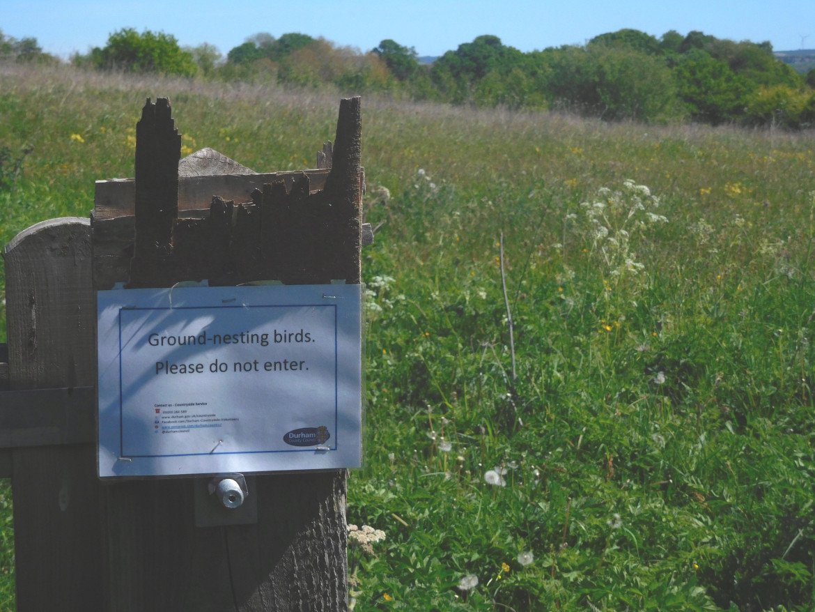
The DCC applied for this land to be deregistered as Common Land and to be replaced by land on Aykley Heads (land that was then closed to the public to protect ground nesting birds). The Durham City Trust worked with the City of Durham Parish Council and the Durham City Freeman to produce arguments that this land should remain as Common Land. Whilst awaiting the public inquiry on this matter, the land remained illegally closed off. The Planning Inspectorate held the public inquiry on April 27-29 2021 (rearranged from 26 January). Unfortunately, the objectors lost their case and this land was deregistered. However, the rest of the Sands Common Land remains safely Common Land.
Aykley Heads replacement landAkyley Heads replacement land earlier view
Quote from Bulletin 93, Autumn 2021
Trustees were disappointed that part of the Sands was judged to have lost its common land status. Durham County Council had made a retrospective application to this effect after developers had appropriated the space of a former coach park for building works during construction of the building then purposed as a new Council headquarters. The area at issue was to be used as a 60-space car park for the new building, even though the new multistorey car park is only a stone’s throw away. The Trust, represented in the public inquiry by Michael Hurlow, had defended the site’s common land status, along with the Durham City Freemen and Durham City Parish council, represented at the inquiry by Roger Cornwell. However, given that the Council is now under new leadership, there must be hopes that a more desirable use of the land can be granted, either in the former of restoring the coach park, centrally placed as a facility for tourism, or even for it to be gifted back to the Freemen. Readers can find the Inspector’s full report at https://bit.ly/3nCNfMG . In reaching his decision Mr Edward Cousins described the replacement common land area at Aykley Heads as a superior amenity for the public to the land being lost, being both larger in area and part of “a wide open-green space of undulating countryside”. Objectors had argued that this land was too far from the Sands to be suitable and would no longer serve as a protected area for nesting birds.
Our featured assets for June 2022 are all the buildings that have been awarded the Trust’s Architectural Award. (See List of assets of the month.)
The purpose of the Trust is to celebrate, protect and enhance the heritage and landscape of the City. The Trust’s Architectural Award is one way in which we celebrate buildings and assets that enhance the heritage and landscape of the City and add community value and enjoyment. Another way we do this are the constructive comments we include in our responses to planning proposals with the aim of improving these proposed developments so they can enhance and add value to our City.
The Architectural Award commenced in 1990, and is an annual award though in some years no award may be made and in others more than one award may be made. The winning buildings are as follows, and a list of the awards is available:
Assembly Rooms, The Bailey (2019)
Hotel Indigo (formerly Old Shire Hall) (2018)
Ogden Centre for Fundamental Physics, University Science Site (2016)
The Bowers, end of Waddington Street (2015)
Diocesan Office and Resource Centre, Stonebridge and Police HQ, Aykley Heads (2014)
57-59 Crossgate (2013)
Eshwin Hall, Esh Winning (2012)
World Heritage Visitor Centre, Owengate and Zizi Italian Restaurant, Sadler Street (2011)
Railway Station (2009)
Freeman’s Quay Leisure Centre (2008)
Calman Leaning Centre, University Science Site (2007)
Science Learning Centre North East, Framwellgate School (2006)
St Brandon’s Church, Brancepeth and the Visual Arts Centre, Sixth Form Centre, The Sands (2005)
Highgate (2004)
Millennium Place (2002)
Cathedrals, Court Lane and Glenmoor Farm, Low Pittington (2001)
Nos 2-3 Waddington Street (1999)
Burn Hall (1998)
Harrison and Harrison Organ Factory, Meadowfield Industrial Estate (1997)
Aykley Heads House (1996)
Claypath Medical practice and Methodist Chapel, Carrville (1995)
St John’s Church, Nevilles Cross (1994)
Fellows’ Garden building, University College (1993)
Burn House and extension, New Elvet (1992)
St Anthony’s Chapel, Claypath (1991)
Nos 86-88A Claypath (1990)
The details of each award is given on the Awards section of the website with a link to the Bulletin or Annual Report where details of the winning building and other candidates can also be found.
Prof Timothy Clark, a trustee of the City of Durham Trust, has edited a booklet ‘The City of Durham Trust Architectural Awards 1990-2009’, of 64 pages with 52 colour illustrations, which is available for purchase from the Trust’s online shop.
The winners of the award are an eclectic group, covering new builds and renovations of old buildings; residential, commercial, public and religious buildings. The criteria that matter are the quality of the design and its implementation, and a positive contribution to the setting and context. In recent years the Trust has extended its coverage to parts of buildings, other architectural features, and green infrastructure.
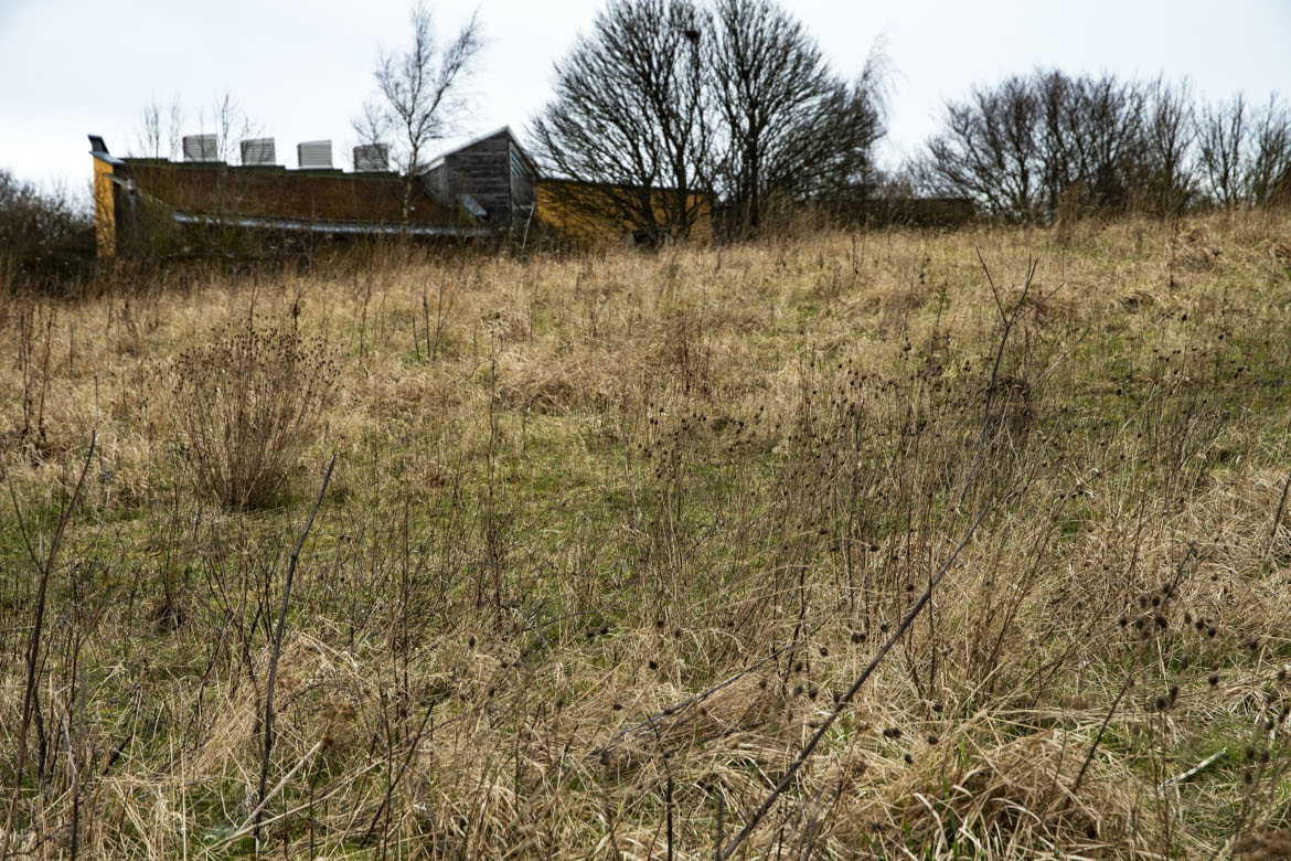
Flass Vale is the featured asset for May 2022. (see List of Assets of the month.) Flass Vale is a green space in the centre of Durham City with a long history of human activities dating back to prehistory. It is a Local Wildlife Site, common land and Nature Reserve, and designated as a Local Green Space in the City of Durham Neighbourhood Plan. A campaign, in which the Trust was involved, was fought in 1973/74 to prevent the area from being developed for housing. This resulted in the present protected green space that we have to day, managed by the Friends of Flass Vale, set up in 2002.
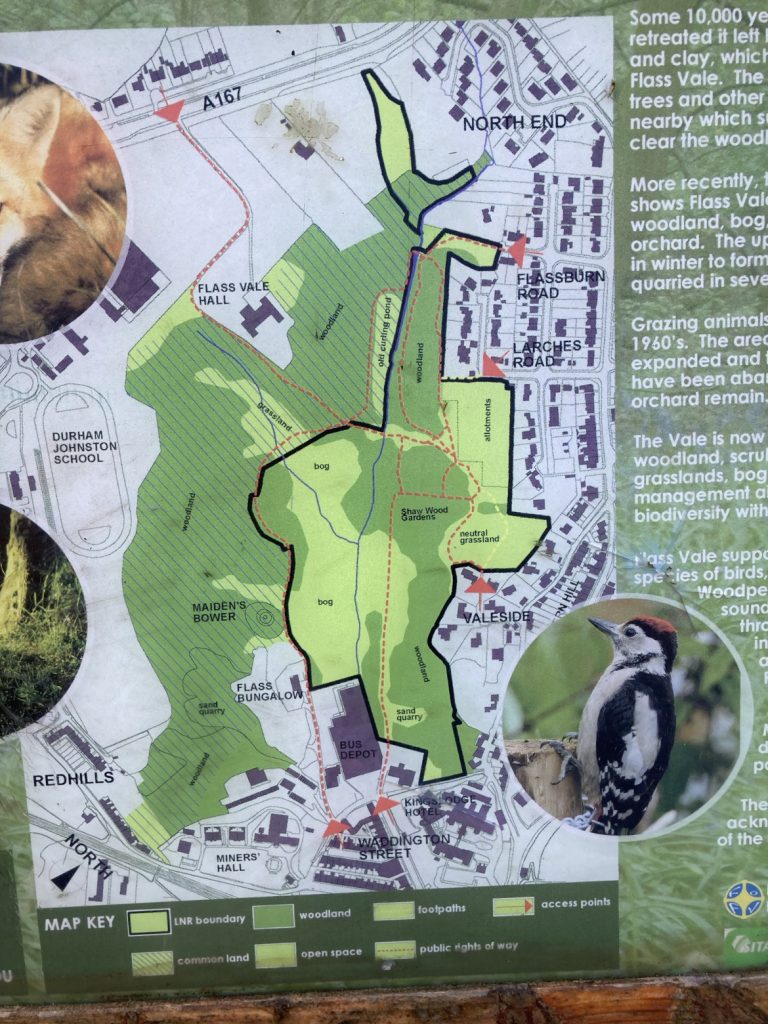
Map of Flass Vale from the information board at the site
The saga started back in 19868/69 when a planning proposal to build houses on Flass Vale was turned down in response to a widespread public outcry against it, comprising petitions, letters to the Durham Advertiser and responses to the planning consultation. The Trust sent in a petition comprising 575 signatures. However, this did not stop the threat of development in Flass Vale. Proposals for development were resubmitted and the then City Council (which only covered the City of Durham and Framwellgate Municipal Borough Council) approved them to huge public outcry, triggering local groups and individuals to set up the ‘Save Flass Vale’ campaign. One of the election pledges of the Labour Party for the election in 1973 of a new City of Durham District Council (embracing the Municipal Borough and Durham Rural District Council and Brandon & Byshottles Urban District Council) was to do a land swap with the developer, i.e. to give him a development site somewhere else. Labour won the election and the new District Council’s first Leader – Cllr Ramshaw – swiftly announced that the deal had been done.
The Council promised that the Vale would remain open land, however further actions were still required to protect it. The Trust submitted evidence to a Commons Commissioner in July 1980 to make Flass Vale common land. Unfortunately, the Council objected and only two thirds of the space was made Common Land. In 1981 the Trust submitted evidence to an Inquiry on the County Council’s Draft Revision of Public Rights of Way for the entrance to the Vale past the former Rose Tree Public House to be made a Public Right of Way, and this was agreed.
See clippings from the Trust Bulletins at the time.
The boundaries of the Vale have experienced more development as recent proposals have been approved, e.g. the Bus Depot and the southwest portion of the Vale have been developed as private housing and student accommodation.
East sideCentreWaddington Street entranceViews of Flass Vale, looking north
The broad shape of Flass Vale was laid down 10,000 years ago when the ice cap retreated, leaving sand, clay and gravel behind as water flooded towards the valley of what is now the River Wear. These deposits formed the hills surrounding Flass Vale. The hill which formed Redhills and the A167 blocked meltwater from flowing through Flass Vale and diverted it into what is now the Browney Valley.
During the Bronze Age the landscape was probably swamp and wet woodland. Pollen analysis from Bearpark Bog suggests that people started to clear woodland in this area around 3,000 years ago. Settlements probably consisted of small farms: the first evidence of human settlement in Flass Vale dates from this period. Maiden’s Bower (a Scheduled Monument) is a Bronze Age burial mound (round cairn).
There is no evidence of human habitation in the Vale until the Medieval period. In this period Flass Vale was incorporated into Crossgate Moor and Framwellgate Moor parishes and most of the Vale was probably rough grazing land, with marshy ground in the valley bottom (‘Flass’ is a Scandinavian word meaning marsh). The valley is drained by the Flass Burn (originally known as the Mill Burn) which drove a corn mill before entering the River Wear. Flass Vale was probably used as a drove route for access to and from the West (Crossgate Moor and beyond) to the Market Place, with the Vale probably being used as a holding area for animals before they were sold at the market, and as winter grazing. A non-designated footpath, thought to be part of the route taken by monks between Durham Cathedral and Beurepaire in medieval times, leads to the A167 from the top of the Vale. Before the Battle of Neville’s Cross (1346) monks from Durham Cathderal carried the corporax of St Cuthbert as a banner during a vigil on Maiden’s Bower.
The Inclosure maps of Crossgate (west) and Framwellgate (east) dating from 1770 and 1802 show many different owners/tenants. The 1838 tithe maps for Crossgate and Framwellgate record most fields as pasture, the north east fields as arable, several gardens, two plantations and patches of woodland (presumably not planted). A small building (Flass Cottage) is marked at the end of a path leading through Flass Bog. One of the fields listed on the 1838 tithe map as Gilbert Knowles, (presumably a misprint for Gibbet Knowle), is said to be the site of a gibbet where hanged bodies from Gallows Field (now St Leonards School) were left to decompose in medieval times.
By the time of the first Ordnance Survey (1858), a public pleasure garden (Shaw Wood) and an extensive orchard had been developed at the south end of the Vale, but by the end of the century (1898 OS map) both had declined. Buildings now known as Flass Vale Hall (Moor Edge Farm), Flass House and the King’s Lodge Inn (Rose Tree Public House) are marked on these maps along with Flass Cottage. The bottom of the valley is marked as Flass Bog. A curling pond was constructed at the north of the Vale by damming Flass Burn (formerly Mill Burn) and used until the 1920’s. Later maps show substantial buildings on the corner of ‘Rose Tree Lane’ and back Western Hill.
Profound changes to the Vale were made in the 20th century with the extraction of sand in several quarries on both sides of the Vale. There was a sewage works at the top of the Vale, which was abandoned and later used as an allotment: in 2009 it was planted as a wild flower glade. A large house – the Larches – was built at the end of a path leading from Fieldhouse Lane and Fieldhouse Terrace. Between the wars the Bus Garage (Omnibus Depot) was built next to the Rose Tree Public House. After the second world war much of the land on the edge of the Vale was developed for housing. But the greatest change was the loss of an agricultural role and the sale of land for housing, resulting in the ‘Save Flass Vale’ campaign of 1973. Durham City Council purchased land to the east of Flass Burn which was designated as a Local Nature Reserve in 2007. The whole of the Vale was designated as a Local Wildlife Site in 1990.
Other resources
Gibby photographic prints collection at Durham University: Flass Vale looking South East showing Presbyterian church Waddington Street and the new Redhills c.1925
The Royal Geographical Society, Discovering Britain, ‘Durham Flass Vale Walk‘, A circular walk from Durham city centre tracing the course of the ‘lost’ river Browney.
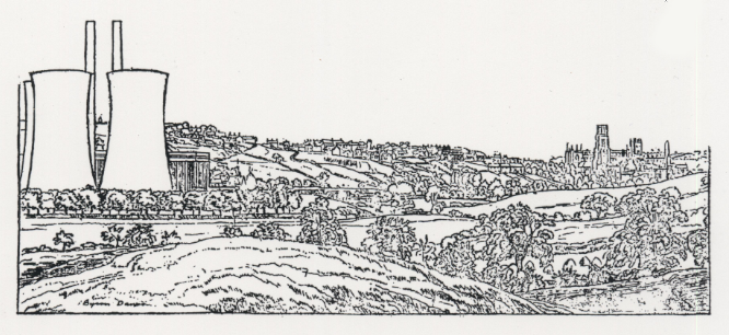
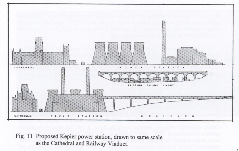
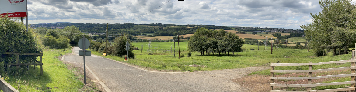
In 1944 a coal-fired power station was proposed alongside the River Wear at Kepier. The North-Eastern Electric Supply Company (NESCo) spent some years planning for the power station and bought up the land where they wished to site it before publicly announcing their plans in 1944. These plans caused a huge public outcry and therefore the government agreed to put the issue to a public inquiry. As a result the proposal for this power station was abandoned. This is the ‘asset’ for April. (See List of Assets of the Month.)
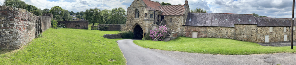
The requirements for the site were (1) access to water, (2) stable ground (i.e. not affected by mine workings), (3) good rail and road access. The site NESCo chose was the old rifle range either side of the River Wear at Kepier: 3/4 of a mile from the Market Place and 1 mile from the Cathedral. The power station would have included a turbine and power house 140 feet high, 2 chimneys 350 feet high to carry away the smoke and dust, and 3 concrete cooling towers 260 feet high. As well as the power station itself major additional works would have been required, e.g. additional railway cuttings into the hillside above Kepier (the coal would have been delivered from across the County to the goods railway station at Gilesgate – now a Travelodge) and a conveyor belt of 6 huge arches leading from the hillside to the power station on the ground below. NESCo planned to sell on the clinker and ash produced, and place the dust and soot (mixed with soil) onto a tip (14 foot high) on the west side of the river. It should be noted that the main body of the Cathedral is 80 feet high, and the tower is 218 feet high. The contemporary drawing and diagram below (Pocock, 2006, cover and p.16) show what the power station would have looked like. The photos show the proposed location nowadays: a rural landscape of fields and the Northern Powergrid training area for power line workers, next to the listed Kepier Hospital.
View of the site nowadays looking westKepier Hospital
NESCo stated that the power station would become a tourist attraction to rival the Cathedral: it should be noted that the architect was Giles Gilbert Scott who designed Battersea Power Station. Despite the advice of their Planning Consultant, the City Council welcomed the scheme because of the employment it would bring to the City and surrounding areas, as long as the plant blended harmoniously with the surrounding countryside and waste products were adequately controlled. Durham was suffering from the effects of the war and the urgent need to rebuild the economy, and before the war Durham had suffered from severe unemployment. Groups such as the Trade Unions, the County Council, and the Farmers Union and some local people supported the proposal. However other local people and organisations were in opposition, e.g. the Cathedral, the University, the urban planner Thomas Wilfred Sharp, and the Trust (at that time the City of Durham Preservation Society which had only been set up in 1942).
The arguments for and against this proposed development resonate with the debates about current day developments in the City: economic and social factors versus cultural and community factors, and the challenge, or even the possibility, of achieving a compromise or balance between them. Quotes from a Durham University Journal 1944 article demonstrate this:
“In short the Power Company and the supporters of the project maintain that a power station at Kepier is both necessary and desirable, that it will bring prosperity to the City, and that its social and economic benefits will be such that no other considerations should be allowed to stand in its way” p.9
The opponents argued that the power station technicians would be recruited from outside the area, and electricity for local people would be no more accessible or cheaper than if the plant was placed elsewhere in the County where there were other, more suitable locations. “The true function of the city, the opponents maintain, is as a cultural, educational, administrative and tourist centre. This function will be seriously disturbed, if not ultimately destroyed, by heavy industrialisation …” p.9
The author of the article in the Durham University Journal focussed on the detrimental effect the power station would have on views from, to and of the Cathedral and the City.
See also some contemporary letters from ‘The Evening Chronicle’, 18th July 1944, and comment in the Times, 13th July 1944:
The objectors appealed to the Ministry of Town and Country Planning to hold a public inquiry and this request was accepted. The public inquiry was held in December 1944. The Trust was the main objector at the inquiry and Thomas Sharp argued its case: “that it was unnecessary to choose this particular site, which would be environmentally disastrous, both in terms of visual and aerial pollution”. [Pocock, 2013, p.137). Following the inquiry a long process of legal, political and financial manoeuvrings delayed the decision until finally in June 1945 the scheme was abandoned. NESCo increased their production at their existing plants and therefore there was no need to build a new power station.
See contemporary parliamentary discussions covered in Hansard:
Fighting this proposal stretched the resources of the new City of Durham Preservation Society to the limit as this heartfelt plea for donations (published in the Times, 29thAug 1945,) shows:
“COST OF OPPOSING DURHAM POWER SCHEME AN OPPORTUNITY TO HELP The trustees. of the Durham Preservation Society, which opposed the erection of an electric power station at Kepier, have issued a statement saying: — “When we undertook to state the arguments against the Kepier Power Station we did so because we feared the case might otherwise go by default. The decision reached would seem to justify our action and to prove—as we hoped it would—that the Ministry of Town and Country Planning is a real guardian of the national interest. To present the case adequately has proved expensive: in spite of the help we have received, it will more than absorb all our small invested capital, and seriously cripple us in the work we hoped to do for the city. We do not complain, for it is the national tradition that public rights should be asserted by private citizens, and we most certainly do not regret the expenditure: but if there are any who feel that in trying to safeguard Durham we have rendered a national service, our treasurer (at the Chapter Offices, Durham) will most gratefully acknowledge any contribution they may be kind enough to send.”
T.S. (1944) Some notes on the power station at Kepier, Durham. Durham University Journal, Dec 1944, 37(1): 8-11. Digitised copy available from Durham University Library http://palimpsest.dur.ac.uk/slp/dujournal.html
Pocock, Douglas (2006) The futures of Durham. A reflective essay. City of Durham Trust. Available for purchase
Pocock, Douglas (2013) The story of Durham. The History Press Ltd
Durham County Record Office. Ref: Q/D/P 593. North Eastern Electric Supply Company Ltd, Kepier Power Station, site plans and elevations by Sir Giles Gilbert Scott, 24 November 1944. Original number 596. Including: /1 plan(s)
Relevant items can be seen on display in the Durham Museum
Note: The content of scanned newspaper clippings has been converted into text for ease of reading.
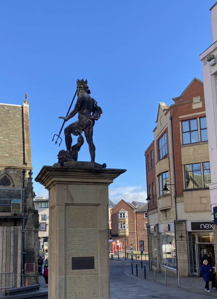
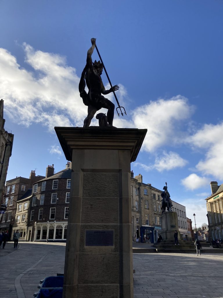
The asset for March 2022 is the Neptune statue located in the Market Place. (See List of Assets of the Month.) Artefacts are important heritage assets, telling historical stories and providing a sense of place and artistic value.
The Neptune statue has had a chequered history and a peripatetic life. The City of Durham Trust was instrumental in saving it for the City as a current historical and artistic artefact.
View towards the North North EastView towards the South
The lead Neptune statue was erected in 1729, in the centre of the Market Place on a contemporary stone pant [public water fountain / wellhead] by Thomas Shirley. A high-quality figure from one of the London workshops, possibly Nost or Charpentière. After crowning later pants of 1863 (by E.R. Robson) and 1902, Neptune was banished to Wharton Park in 1923, restored (1986), set on a new plinth in 1991 (by Martin Roberts of Durham City Council), then resited. Roberts, M, Pevsner N, and Williamson, E (2021), County Durham, Yale University Press, p. 345
The current location of the statue resulted from the repaving and repurposing of the Market Place to an ‘event space’ in 2011-13. Its current location exposes it to the risk of damage from traffic.
The two inscriptions on the current plinth read:
This statue was given to the City in 1729 by George Bowes M.P. of Gibside and Streatlam as a symbol of the scheme to link Durham to the sea by improved navigation of the River Wear. It stood on top of the Market Place wellheads until 1923, when it was moved to Wharton Park. It was restored in 1986 following an appeal initiated by the City of Durham Trust.
It should be noted that this navigation scheme came to nothing because of geographical constraints on the River and therefore huge financial implications to overcome these, although enabling legislation was passed in parliament.
This statue was restored to its traditional home in the Market Place by the City of Durham Council on the 16th of May 1991. It was unveiled by The Right Worshipful the Mayor of Durham, Councillor W.H. Hartwell. Present were many of the individuals and representatives of local and national organisations who had generously supported the restoration appeal and the resiting.
Neptune was severely damaged by lightning in 1979 at its location in Wharton Park and needed restoration.
As the Advertiser aptly expressed it, “the old man from the sea has been struck by a bolt from the blue”. Lightning brought about his final downfall, and he is now in storage, in pieces. Trust Bulletin Number 19, November 1980
The Trust investigated the state of the statue and was advised it was worth restoration. The Trust therefore started a Neptune Appeal in early 1983 to raise £10,000 to restore the statue and have it erected in the centre of Durham. It received support from, among others, ‘Tidy North Beautiful Britain Group’, local councillors, and the planning office. Events to raise money included a ‘Splash Out for Neptune’ dinner on 26th May 1983, a fête at Brancepeth Castle on Saturday July 11th 1983, a raffle in 1984, a Jumble Sale in July 1985, and a Grand Bazaar in the Town Hall in October 1985. Many donations from individuals were received. The ‘North of England Museum Service’ gave a grant of £2,300, and promised work worth £1,000 in connection with setting up the statue after restoration. Support was also received from the ‘Hadrian Trust’ and the ‘Pilgrim Trust’. The required total was successfully reached in November 1986. The statue was sent to the Restorer Mr A. Naylor of Telford in 1984 and once restored was displayed in the window of the gas showrooms in Claypath, later Oldfields Restaurant and now demolished when the Student Castle PBSA was built. It took many more years, and discussions and bureaucratic procedures until Neptune was finally located in the Market Place on 16th May 1991. A celebratory event was held in the Town Hall on 31st October 1991. From destruction to resurrection took 12 years! The value of an organisation like the City of Durham Trust is that it has a long-term existence and can take on long projects.
An entry in the Trust Bulletin Number 25, November 1986, describes the five times that Neptune was “faced with oblivion”:
The Neptune project demonstrates the commitment of local people to the City’s heritage. A description in the Trust Bulletin Number 22, November 1983, of the fête at Brancepeth Castle illustrates this:
The fund-raising artistic activities are particularly noteworthy:
a ‘Song for Neptune’ composed and performed by Gerry Caley
a play for Neptune, written and performed by the Gilesgate Junior School History Club, under the leadership of Miss C. Martin
a poem composed and donated by the versatile actor and poet, Graham Tennant. A limited number were printed and inserted inside a card for sale, showing Neptune and the Pant in the Durham Market Place of 1922
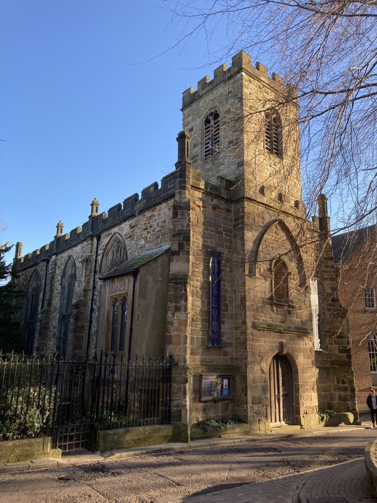
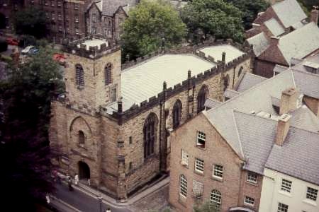
St Mary-le-Bow, a redundant parish church, is our featured heritage asset for February. (See List of Assets of the Month.)
St Mary-le-Bow is a Grade I listed building located on the corner of The Bailey and Bow Lane, near the Cathedral. It is now the Durham Museum, showcasing the history of Durham and the City.
St Mary-le-Bow from the Bailey
St Mary-le-Bow’s origin is in the medieval period as the parish church serving people living in the North Bailey. In that period an arch connected the church tower to the fortifications creating a gateway or ‘bow’, with a room in the tower for a chantry priest who prayed for the souls of the deceased. However, the gateway, the tower and much of the west end of the church collapsed in 1635. The church wasn’t rebuilt until towards the end of the 17th century, with most of the buildings dating from the 1670s and the tower from 1702. The church continued its religious function until it was closed in 1968.
Because the current Church is a reconstruction of an older building, it combines elements of different dates. The roof, for example, dates from the 15th century. The wooden screen before the altar dates from 1707, while the wooden panelling dates between 1731 and 1742. There are two baptismal fonts, one dating from the 18th and the other from the 19th century.It is common for community buildings, such as churches, to go through periodic refurbishment campaigns, and receive gifts from time to time. This church is no exception.World Heritage Site
St Mary-le-Bow rooftop view
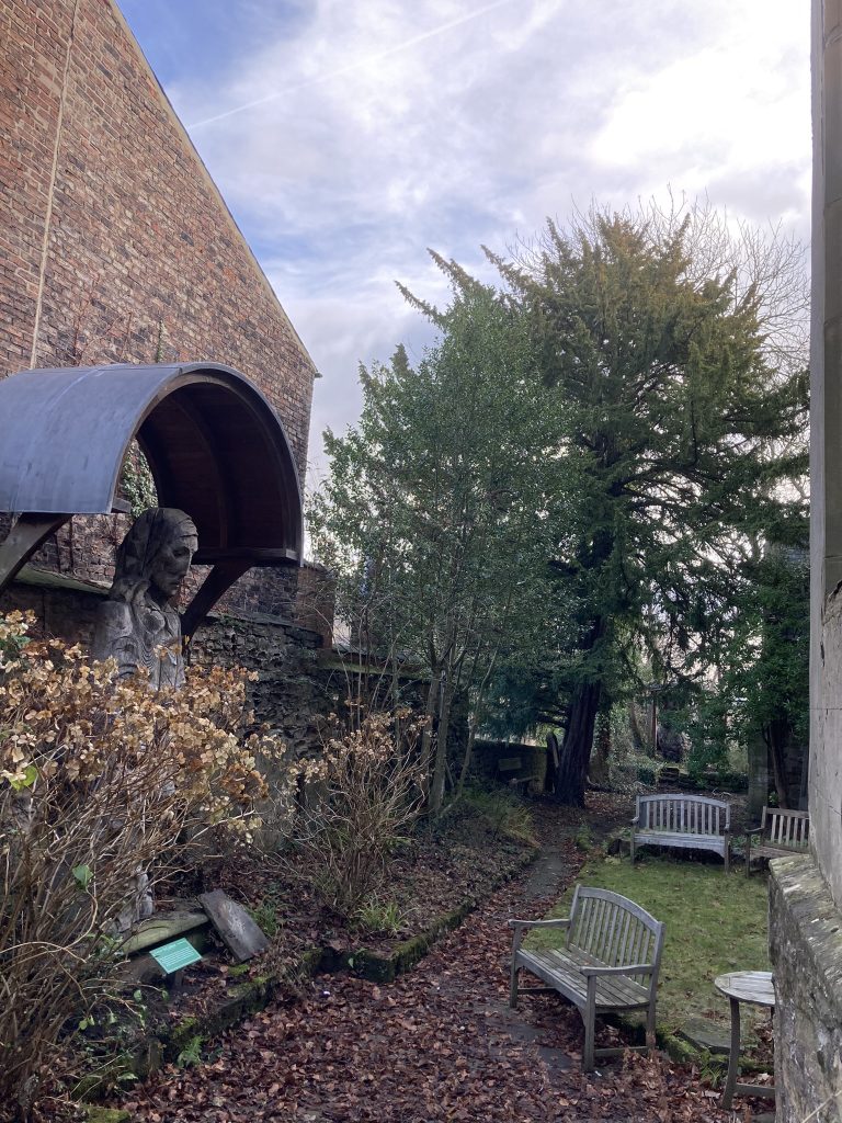
The Durham Museum now occupies the building. The Museum presents the history of the people of Durham from medieval times to the present day, using objects, models, pictures and audio-visual media.
The Museum’s sculpture garden contains works by the Durham sculptor, Fenwick Lawson, ARCA. The sculpture (show below) of St Cuthbert was carved in 1984 from an elm tree that grew in front of Durham Cathedral. St Cuthbert stood in Durham Cathedral Cloisters for two decades. In 2004 a bronze was created, funded by the Northern Rock Foundation. The bronze now stands in the Priory at Lindisfarne on Holy Island. In 2005 the original wood carving was donated to Durham Museum.
St Mary-le-Bow sculpture garden, showing the Fenwick Lawson sculpture of St Cuthbert entitled ‘Cuthbert of Farne’.
The Museum is run by The Bow Trust, a registered charity “established in 1975 to maintain the redundant church of St Mary-Le-Bow in Durham City as a centre for exhibitions and activities related to the history and antiquities of both the City and County Durham, and for other educational and cultural benefits.” The heritage centre has now evolved into an Arts Council England Accredited Museum.
The City of Durham Trust was involved in the campaign to set up The Bow Trust and save the church. An entry in the Trust’s Bulletin Number 7, December 1971, discusses the necessity of saving the church and notes: “It is too long since we had a chance to see the interior – the exterior is gladly taken for granted by us all as a delightful and indispensable part of an intimate and crowded street scene.” When the original Trust was formed a number of local societies and organisations were nominated and a member elected to serve on the Bow Trust committee. These included: The City of Durham Trust, The Architectural and Archaeological Society of Durham and Northumberland, Durham Cathedral, The City of Durham (now Durham County Council) and Durham County Art and Architectural Society. The City of Durham Trust continues to actively support the Bow Trust, nominates a trustee to the Bow Trust, and pays a subscription.
Durham Museum will be open again from the Easter weekend, 11am to 4pm. This includes being open on Easter Monday 18 April for the Durham World Heritage Site Festival